After weeks of widespread downpours and flooding concerns, a drier pattern is taking shape. The focus now shifts to dangerous heat as heat index values approach advisory levels Monday and Tuesday.

Today and tonight: A few showers and thunderstorms will still be possible today, but coverage will be noticeably lower than what we've seen recently. Most locations will spend more time dry, allowing temperatures to climb into the lower and middle 90s. Any storm that develops could still produce brief heavy rain, gusty winds, and frequent lightning, but the widespread flooding threat continues to diminish as tropical moisture pulls away from the region.
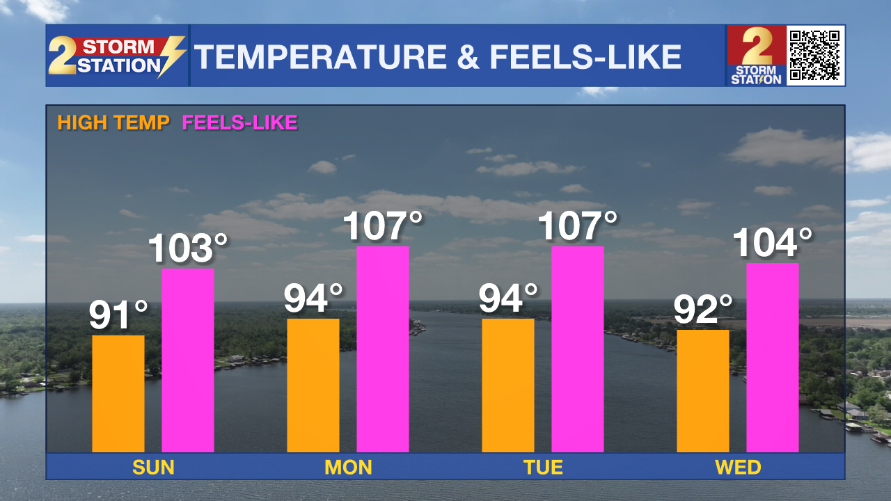
Up Next: Monday and Tuesday look much drier with only spotty storm chances. The bigger concern will be the heat as temperatures climb into the 90s and heat index values approach 108 degrees. Heat Advisories may become necessary as the combination of hot temperatures and Louisiana humidity creates dangerous conditions for anyone spending extended time outdoors.
Tropics: The National Hurricane Center is not monitoring any areas for tropical development. No tropical cyclone formation is expected across the Atlantic Basin during the next seven days.
Get the latest 7-day forecast and real-time weather updates HERE.
Watch live news HERE.
– Dave
The Storm Station is here for you, on every platform. Your weather updates can be found on News 2, wbrz.com, and the WBRZ WX App on your Apple or Android device. Follow WBRZ Weather on Facebook and X for even more weather updates while you are on the go.