

Latest Weather Blog
Monday AM Forecast: Tracking high heat and a tropical disturbance
A HEAT ADVISORY will be in effect until 7 p.m. Monday for many around the Capital Area, including parts of Ascension, Assumption, East Baton Rouge, Iberville, Livingston, St. James, Tangipahoa, and West Baton Rouge Parishes. Expect feels-like temperatures to sit in the 105-108° range for several hours during the afternoon, possibly reaching 110° in some neighborhoods. Drink plenty of fluids, wear light clothing, and take breaks during the hottest parts of the day.
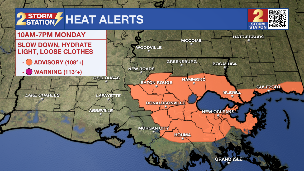
Today & Tonight: Stay cool and weather-aware today! A Heat Advisory is in effect for Baton Rouge on Monday as temperatures will reach the low to mid-90s, but thanks to extreme humidity, it will feel like 105–110° in some spots. A few strong, isolated storms could pop up this afternoon, with about 40% of the area seeing rain. Tonight, storms end after sunset, skies clear, and lows dip into the mid-70s.
Up Next: A high-pressure system over the state Tuesday will keep most storms at bay, with only spotty activity expected—about 20% coverage. As a result, it will likely be the hottest day of the week, with highs in the mid-90s and plenty of sunshine. Feels-like temperatures will soar into the triple digits, possibly prompting another Heat Advisory. The heat sticks around Wednesday, but a few more afternoon storms are expected.
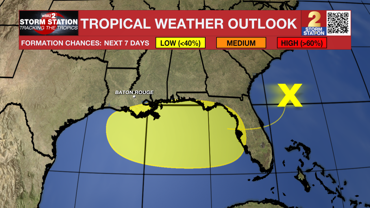
Abundant tropical moisture will move in by Thursday as a tropical disturbance nears the region, bringing several very wet days. Rainfall totals of 2–4 inches are likely, with locally higher amounts possible. Isolated flash flooding can't be ruled out. Details are still coming together, so stay tuned for updates. More on the system's potential development is outlined below.
Trending News
The Tropics: A trough of low pressure located offshore the Atlantic coast of northern Florida is producing disorganized showers and thunderstorms across portions of Florida, the northwestern Bahamas and adjacent Atlantic waters. This system is forecast to move westward across Florida during the next day or so, and into the northeastern Gulf by late Tuesday. Environmental conditions appear favorable enough to support some gradual development of this system. At the same time, it will move westward to west-northwestward across the northeastern and north-central portions of the Gulf during the middle to latter part of this week. Regardless of development, heavy rainfall could produce localized flash flooding over portions of Florida and the north-central Gulf coast through the middle to latter portion of this week.
Get the latest 7-day forecast and real-time weather updates HERE.
Watch live news HERE.
– Emma Kate C.
The Storm Station is here for you, on every platform. Your weather updates can be found on News 2, wbrz.com, and the WBRZ WX App on your Apple or Android device. Follow WBRZ Weather on Facebook and X for even more weather updates while you are on the go.
More News
