

Latest Weather Blog
Wednesday AM Forecast: Storm Chances Climb Through Thursday, Then Ease Into Weekend
The main story this week: heat, humidity, and hit-or-miss storms each day. Radar activity ramps up through Thursday, then eases into the weekend.
Today & Tomorrow: Over the next two days, storm activity will increase each afternoon as Louisiana sits between two high-pressure systems. This setup will boost the chance for scattered to numerous storms, especially across the Capital Region on Wednesday and Thursday. Neither day looks like a total washout, and with some early sunshine, highs should still reach the low 90s. Overnight, lows will dip into the mid-70s with clearing skies and little to no rain after sunset.
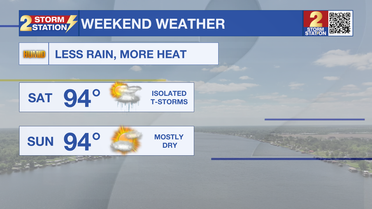
Up Next: Storm chances will gradually decrease each day as we move into the weekend. A high-pressure system currently to our east will shift over southern Louisiana, reducing rain and boosting temperatures. By early next week, upper-level ridging will take over, bringing mostly dry skies and possibly the hottest weather we've seen so far this summer.
The Tropics: For the Gulf, Caribbean, and North Atlantic, all is quiet. No tropical development is expected during the next 7 days.
Trending News
Get the latest 7-day forecast and real-time weather updates HERE.
Watch live news HERE.
– Emma Kate C.
The Storm Station is here for you, on every platform. Your weather updates can be found on News 2, wbrz.com, and the WBRZ WX App on your Apple or Android device. Follow WBRZ Weather on Facebook and X for even more weather updates while you are on the go.
More News
