

Latest Weather Blog
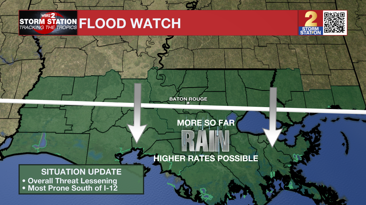
Flood Watch continues, downpours possible again on Friday
Moisture from a weak tropical disturbance will maintain the possibility of heavy showers and thunderstorms through Saturday. By Sunday and early next week, a more typical summertime pattern will return.
A FLOOD WATCH remains in effect through Friday Night for all of South Louisiana as excessive rainfall continues to be possible. Thunderstorms are expected at times through early Friday evening, with rainfall rates in excess of 2 to 4 inches per hour possible. An additional 2 to 4 inches, with locally higher amounts, is expected. Excessive runoff may result in flooding of creeks, streams, and other low-lying and flood-prone locations. Flooding may occur in poor drainage and urban areas.
A FLOOD WATCH means conditions may develop that lead to flash flooding. Flash flooding is a very dangerous situation. Be on the lookout for threatening weather conditions and listen for later statements and possible warnings. For more on flooding safety, CLICK HERE.
Tonight & Tomorrow: The tropical system responsible for an uptick in rain and thunderstorms will drift across the region to end the workweek. Expect scattered to numerous showers and thunderstorms to continue popping up around the weak surface circulation and generally follow the summertime rhythm—more active during the day and less active at night. Tonight will be mainly cloudy with just isolated showers and thunderstorms. Very humid air will remain in place and keep lows in the upper 70s. Friday, rain coverage will remain high at 80%, with downpours possible—some spots could pick up 2 inches or more. There may be some more breaks in the action when compared to Thursday, and even some peeks of sunshine. Tropical moisture in the air will also keep it steamy outside, with highs in the upper 80s.
Trending News
Up Next: After a soggy end to the week, things will gradually start drying out—but not without some heat tagging along for the ride. Rain coverage will decrease further on Saturday to 60%, with scattered showers and thunderstorms during the daytime hours. More dry time is anticipated with highs in the upper 80s and low 90s. The trend will continue on Sunday with a restoration of usual July conditions. Humidity and highs in the low 90s will give way to isolated, afternoon showers and thunderstorms.
Monday through Wednesday look mostly dry, with highs reaching the low to mid-90s. Combined with high humidity, heat index values could become dangerous, and heat advisories may be needed again. There’s a hint that another disturbance in the Gulf could bring rain back by Thursday, which might slightly tamp down the heat, but that’s still uncertain. For now, plan for a hot stretch ahead and stay weather-aware, especially with limited rain to cool things down.
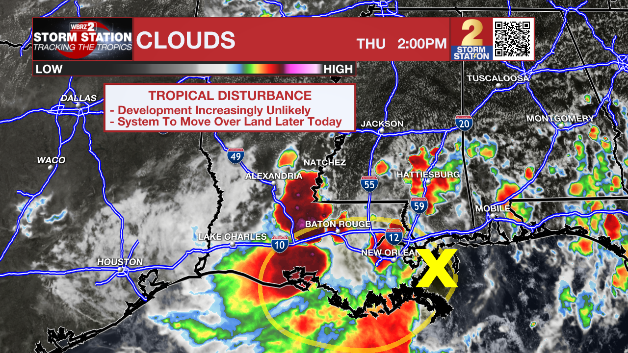
The Tropics: For the Gulf, Caribbean, and North Atlantic, all is quiet. No additional tropical development is expected during the next 7 days.
Get the latest 7-day forecast and real-time weather updates HERE.
Watch live news HERE.
– The Storm Station
The Storm Station is here for you, on every platform. Your weather updates can be found on News 2, wbrz.com, and the WBRZ WX App on your Apple or Android device. Follow WBRZ Weather on Facebook and X for even more weather updates while you are on the go.
More News
