

Latest Weather Blog
Friday AM Forecast: Early clouds to temper 4th of July heat, the weekend remaining hot
Early clouds on the Fourth may briefly ease the heat. Eventually the sun will poke out, warming temperatures to support a few pop-up storms. Over the weekend, heat will surge.
Fourth of July: Early cloud cover and morning sprinkles will work to take the edge off the heat. But sunshine will return for many by afternoon. Clearing will take place for communities northeast of Baton Rouge initially and migrate southwest with time. Areas near the Atchafalaya Basin and coast will hang on to cloud cover the longest. Even with a delayed warmup, highs have the potential to reach the low 90s depending on sunshine. That will be warm enough to pop spotty showers and storms. Any leftover showers will gradually wrap up through the evening. For WBRZ’s Fireworks on the Mississippi, expect clearing skies with temperatures falling into the low 80s. The rest of the night will feature mainly clear skies with a low in the mid 70s.

The Weekend: A wave of dry air will move into the region on Saturday, keeping rain to a minimum. Mostly sunny skies and a lack of rain will result in a fast temperature climb with highs soaring into the mid 90s. On Sunday, moisture will start easing back in. A few more storms will ignite in the heat of the day as a result.
Looking Beyond: Temperatures will start coming down next week as afternoon storms maintain more of a presence. Rain may not necessarily be limited to the afternoon, but it will be enhanced by daytime warming. That will be the case until about midweek. Then, another ridge of high pressure will build and pattern to flip-flop again.
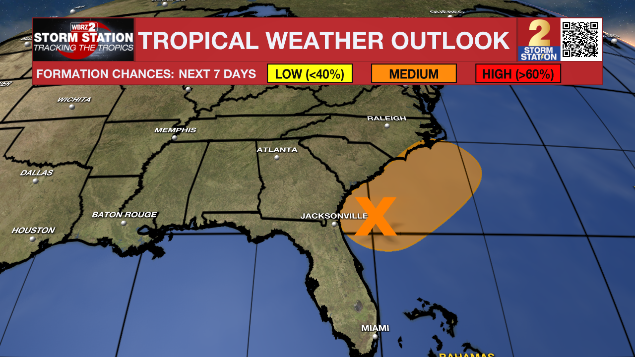
The Tropics: A weak area of low pressure has formed east of Jacksonville, Florida. Conditions may support further development into a tropical or subtropical depression later today or on Saturday as the system drifts northward. The disturbance will move inland over the Southeast Saturday night or early Sunday. Regardless of development, heavy rain is possible across parts of Florida and coastal sections of the Carolinas. An Air Force Reserve Hurricane Hunter aircraft is scheduled to investigate the system on Friday. Local impacts from this system are not expected.
Trending News
Get the latest 7-day forecast and real-time weather updates HERE.
Watch live news HERE.
— Meteorologist Malcolm Byron
The Storm Station is here for you, on every platform. Your weather updates can be found on News 2, wbrz.com, and the WBRZ WX App on your Apple or Android device. Follow WBRZ Weather on Facebook and X for even more weather updates while you are on the go.
More News
