

Latest Weather Blog
Saturday PM Forecast: Storms ramping up late this weekend, into next week
Despite plenty of dry time, dodging rain might prove more challenging for the second half of the weekend. The same old song and dance will play out next week as well: warm, muggy, with scattered afternoon storms.
Tonight & Tomorrow: A muggy and mild night lies ahead, with mostly clear skies and lows in the mid-70s. Escaping rain will be a more difficult task on Sunday as tropical moisture creeps into the area. Showers and storms of the scattered variety will develop by afternoon, delivering rain to roughly half of the Capital Region. But the day will not be a total washout. With plenty of dry time, don’t cancel outdoor plans; however, be prepared to head inside if thunder rolls in. Highs will run slightly below average, stopping in the low 90s.
Up Next: A continued presence of tropical moisture will lead to a healthy scattering of storms each day through at least midweek. Afternoons will be the most active periods, which could put a damper on some commutes and after-school activities. Temperatures won’t budge much either, with highs in the low 90s and lows settling in the mid-70s. The coverage of rain will start tapering by the end of the workweek. As storms become more isolated, temperatures will begin inching higher. Afternoon highs should return to the mid-90s by the weekend.
The Tropics: True to August form, tropical activity in the Atlantic is ramping up. The primary area of interest across the entire basin is a tropical wave situated just off the west coast of Africa. Conditions appear favorable for gradual development of this system. Odds are increasing for a tropical depression to form by mid-to-late week as the disturbance drifts west through the tropical Atlantic.
Long-term, there’s a considerable amount of uncertainty as to where the system will go. It’s important to remember that forecast confidence will remain low until a system actually forms. There is no immediate concern for the local area as of now, but it’s a good time to stay aware. Any potential U.S. impacts would be 10+ days away, and that’s in a world where the system doesn’t curve out to sea. There’s plenty of time to watch things.
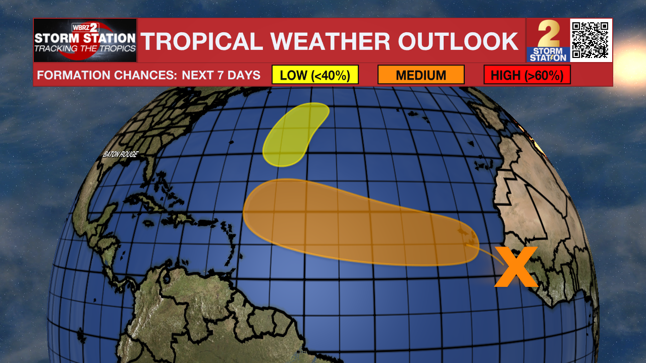
Meanwhile, another tropical wave is located in the central tropical Atlantic. Development odds are decreasing with this system. Tropical development now appears unlikely due to surrounding dry air.
Trending News
Get the latest 7-day forecast and real-time weather updates HERE.
Watch live news HERE.
— Meteorologist Malcolm Byron
The Storm Station is here for you, on every platform. Your weather updates can be found on News 2, wbrz.com, and the WBRZ WX App on your Apple or Android device. Follow WBRZ Weather on Facebook and X for even more weather updates while you are on the go.
More News
