

Latest Weather Blog
Friday PM Forecast: Higher storm chances targeting a portion of the weekend
Keep an eye on the sky through the weekend and much of next week. Daily showers and thunderstorms will remain in play, but a subtle shift in pattern could result in a few changes closer to the Fourth of July.
Tonight & Tomorrow: In true summer fashion, a few storms may linger into the evening before fading away with the loss of daytime warming. As skies clear out, temperatures will fall into the mid 70s. Morning sunshine will become partly obscured by cotton ball-shaped cumulus clouds as temperatures heat up. Those will grow taller as the day wears on, eventually maturing into thunderstorms. Rain will be isolated with roughly 40% the Capital Area collecting measurable rain at some point. While there will be plenty of dry time, frequent lightning and gusty winds will be an issue with storms. Keep an ear out for thunder — lightning can strike anywhere it’s rumbling. Before storms send out rain-cooled air, highs will top out in the low to mid 90s.
Up Next: A spike in tropical moisture will result in a greater number of storms on Sunday. Numerous showers and storms are expected, and they could kick off a little earlier. Activity appears to start off near the coast during the morning and drift northward with time. The majority will collect a downpour on Sunday. Highs will vary from town to town, nearing 90° in Baton Rouge but likely cooler farther south where rain starts earlier in the day.
Next week, the familiar summer pattern will continue. Scattered afternoon storms will be a possibility for much of the week with highs in the low 90s and lows in the mid 70s. There are some signs of rain chances easing into the Fourth of July holiday. In that scenario, daytime highs would climb a few degrees higher.
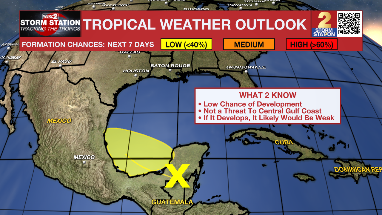
The Tropics: A broad area of low pressure has formed over the Yucatan Peninsula associated with a large and disorganized region of showers and storms. This activity will move into the southwest Gulf over the weekend. There is a low chance of tropical development as this happens. Should it develop, it would likely remain a weak system. Steering currents would keep it far from Louisiana. The system will move inland over Mexico early next week, ending any opportunity for additional development. Regardless, locally heavy rain is likely over parts of Belize, Guatemala, and southeast Mexico in the coming days.
Trending News
Get the latest 7-day forecast and real-time weather updates HERE.
Watch live news HERE.
— Meteorologist Malcolm Byron
The Storm Station is here for you, on every platform. Your weather updates can be found on News 2, wbrz.com, and the WBRZ WX App on your Apple or Android device. Follow WBRZ Weather on Facebook and X for even more weather updates while you are on the go.
More News
