

Latest Weather Blog
Saturday AM Forecast: Warm weekend with a side of afternoon storms
It’s a classic Louisiana weekend—hot, humid, and just waiting for an afternoon storm to crash the party. Keep the sunscreen and umbrella handy… you’ll probably need both!
Today & Tonight: Saturday will be warm and partly sunny, with afternoon highs in the low 90s. The morning should stay mostly dry, but as temperatures rise, scattered thunderstorms are expected to develop. Early storms will likely form closer to the coast before drifting inland. A few isolated storms could pass through the Capital Area during the afternoon and early evening. While not everyone will see rain, outdoor plans should be made with caution—any storm that forms could arrive quickly and bring heavy downpours and frequent lightning. Skies will gradually clear overnight, with lows settling in the 70s.
Up Next: Sunday will be more active, with extra tropical moisture bringing a better chance for storms. Most of the Capital Region can expect at least one, if not a few, passing thunderstorms. Thanks to the rain, highs may stay in the 80s, but it will still feel muggy.
Looking ahead to next week, the pattern holds steady—humid mornings, hot afternoons in the 90s, and daily storm chances. There are some early signs that rain chances may decline by the Fourth of July, which would allow temperatures to climb a bit higher.
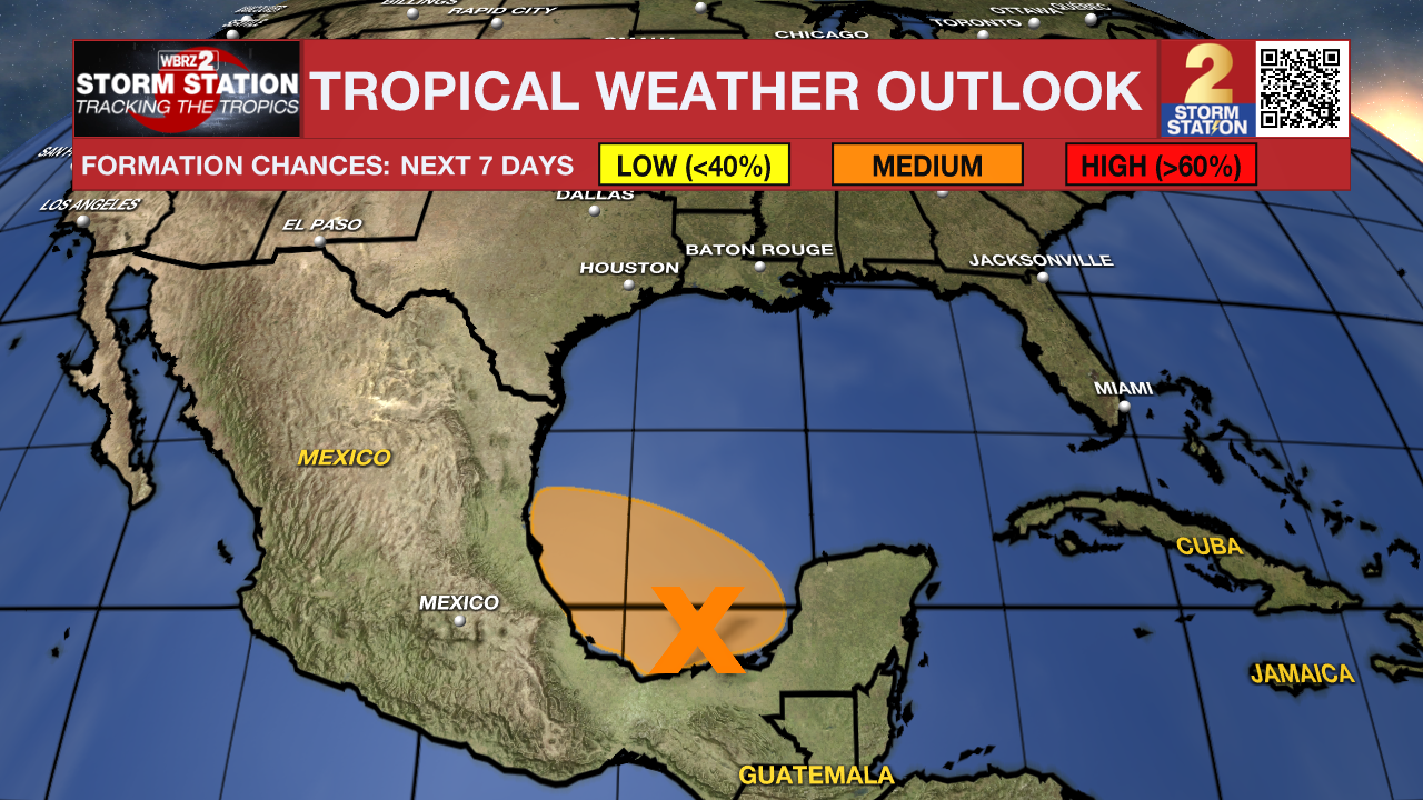
The Tropics: An area of low pressure located in the eastern Bay of Campeche near the Mexican coastline continues to produce a broad region of disorganized shower and thunderstorm activity over the Yucatan Peninsula and adjacent waters early Saturday. Additional development is possible today and Sunday as the low moves generally west-northwestward, and a tropical depression could form during this period while the system remains over the waters of the Bay of Campeche. By Monday, this system should move inland over eastern Mexico, ending its chances of development. Regardless of tropical cyclone formation, locally heavy rains are possible over portions of Belize, Guatemala, and southeastern Mexico during the next few days.
Trending News
Get the latest 7-day forecast and real-time weather updates HERE.
Watch live news HERE.
— Emma Kate C.
The Storm Station is here for you, on every platform. Your weather updates can be found on News 2, wbrz.com, and the WBRZ WX App on your Apple or Android device. Follow WBRZ Weather on Facebook and X for even more weather updates while you are on the go.
More News
