

Latest Weather Blog
Monday PM Forecast: Another cold front tomorrow, next impact targets the weekend
Humidity will sneak back in tomorrow ahead of another cold front. But don't expect much fanfare, only a few passing showers and storms. Closer to the weekend, a stronger system could bring a better chance of rain.
Tonight & Tomorrow: With humidity inching higher after dark, morning lows won’t be quite as chilly. Temperatures will struggle to drop below 60° in Baton Rouge, about 10° warmer than early Monday. North of I-12, a few spots could still sneak into the upper 50s. Humidity will continue to rise on Tuesday. While not terribly humid, it will feel sticky at times. Highs will be a little warmer too, topping out in the mid-80s. These changes will not be permanent; another cold front will be on the way. As it moves in, isolated showers and storms may develop. They’ll be hit-or-miss and quick to pass, so don’t expect much rain overall.
Rest of the Week: Another blast of cooler and drier air will take over behind Tuesday’s cold front. Look for a mainly sunny sky on Wednesday and Thursday with highs returning to the lower 80s. Another chilly start is expected Thursday, with lows bottoming out in the upper 40s to low 50s. While still comfortable on Friday, humidity will start to build again.
The Next Impact: The muggy feel will return in full force by the weekend, just as a stronger upper-level disturbance pushes into the region. Another round of showers and thunderstorms will accompany it. Although it’s still too far out for specifics on timing, rain appears to reenter the picture sometime Saturday or Saturday night. And with an SEC showdown at Tiger Stadium around that time, fans will want to stay in touch with the latest forecast — it will become more refined later in the week. Storm chances will drop into Sunday and Monday, but don’t expect much of a change in feel.
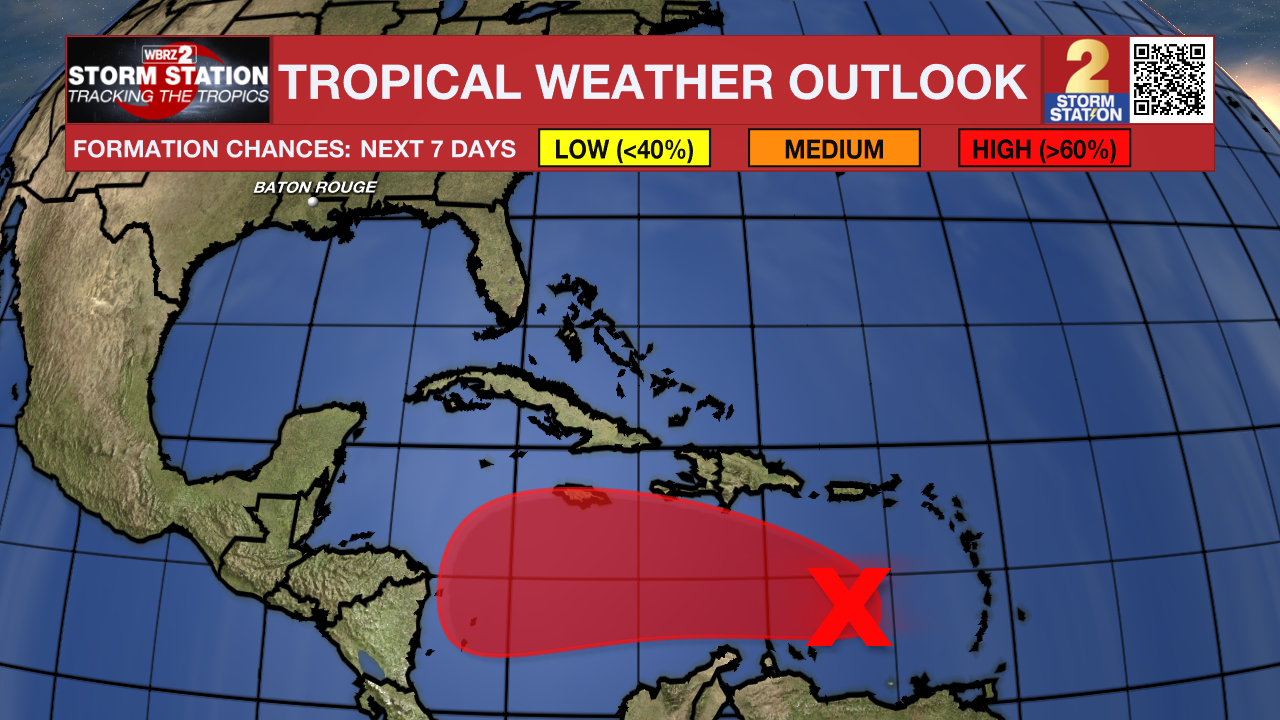
The Tropics: Recent satellite data indicate that a tropical wave located over the eastern Caribbean Sea still lacks a closed circulation. That said, it is becoming better defined. As conditions become more favorable for tropical development in the next day or so, a tropical depression is likely to form. Puerto Rico, Hispaniola, Jamaica, and Cuba should monitor the progress of this system as there is a risk of heavy rain, strong winds, and rough surf later in the week. The system is the most-likely candidate to take the name Melissa.
Trending News
Get the latest 7-day forecast and real-time weather updates HERE.
Watch live news HERE.
— Meteorologist Malcolm Byron
The Storm Station is here for you, on every platform. Your weather updates can be found on News 2, wbrz.com, and the WBRZ WX App on your Apple or Android device. Follow WBRZ Weather on Facebook and X for even more weather updates while you are on the go.
More News
