

Latest Weather Blog
Sunday PM Forecast: Enjoy one more pleasant day, a heavy rain threat lurks
Enjoy one final day with sunshine, warmth, and low humidity. Multiple rounds of showers and storms return for the rest of the week. Flash flooding will be a consideration with this stretch of active weather—that is the next impact.
Tonight & Tomorrow: A pleasantly warm evening will turn cool and crisp overnight. Look for a wake-up temperature in the low to mid-50s across the Capital Area. Consider taking a light jacket for the morning commute. But with mainly sunny skies, temperatures will warm rapidly. Highs will climb into the lower and middle 80s, right on track with early May averages. The humidity will also remain low. Take advantage of the beautiful weather—it won’t last!
Up Next: Rapid changes will take place on Monday night as a warm front slides through the region. Clouds will increase through the night, with isolated showers and storms possible by daybreak. The all-too-familiar humidity will also make a return as early as Tuesday morning. And with a front in the area, numerous showers and thunderstorms will be possible through the day. Confidence is growing for an organized complex of thunderstorms to roll through late Tuesday, into Wednesday morning. Most would see rain from this. Intense rain rates could lead to a few inches of rainfall in a short period in spots, so flash flooding is a concern with this round. Those commuting on Wednesday morning might need to look out for areas of standing water. Severe weather is not off the table either, with gusty winds and isolated tornadoes being the primary concerns.
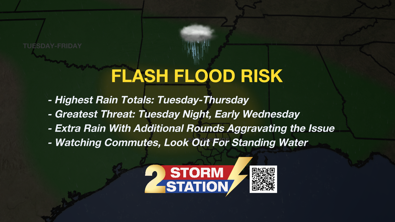
What happens on Tuesday night will set the stage for Wednesday. This introduces some uncertainty at that point in the forecast. Nevertheless, leftover moisture and additional disturbances will keep rain chances elevated. The same goes for Thursday. Any extra rain would aggravate the flash flood risk further. All told, 3-6” of rain with locally higher amounts appears likely in the next week. Most of that will fall into the Tuesday to Thursday timeframe. Moisture will begin exiting around Mother’s Day Weekend. While a spotty shower cannot be ruled out, the upcoming weekend appears relatively drier.
Trending News
River Flooding: The National Weather Service has issued a RIVER FLOOD WARNING for the Mississippi River at Red River Landing, Baton Rouge, Donaldsonville, and Reserve, as well as the Atchafalaya River at Morgan City.
• At Red River Landing, flood stage is at 48 feet. The river has already crested at 59.5 feet. The river remains in moderate flood stage with levels falling. At current levels, Angola farmland on the left bank becomes inundated. All river islands along the reach from Red River Landing to Baton Rouge will remain inundated with recreational camps and river bottom farmland under water. This gauge will fall below flood stage around May 21.
• At Baton Rouge, flood stage is 35 feet. The river has already crested at 42.2 feet. The river remains in major flood stage with levels slowly falling. At current levels, the grounds of the older part of Louisiana State University's campus become soggy. This includes the area around the Veterinary Medicine building, the Veterinary Medicine Annex, and Alex Box Stadium. Levees protect the city of Baton Rouge and the main LSU campus at this level. Caution is urged when walking near riverbanks. This gauge will fall below flood stage around May 12.

• At Donaldsonville, the flood stage is at 27 feet. The river has already crested at 30.9 feet. The river remains in moderate flood stage with levels slowly falling. At current levels, navigation becomes difficult for smaller river craft. Safety precautions for river traffic are urged. This gauge will fall below flood stage around May 11.
• At Reserve, flood stage is at 22 feet. The river has already crested at around 23.7 feet. The river remains shy of moderate flood stage with levels slowly falling. At current levels, marine and industrial interests along the river, upstream barge operators, and facilities are impacted. Navigation will become difficult for smaller river craft. This gauge will fall below flood stage around May 9.
• At Morgan City, flood stage is at 6 feet. The river has already crested at around 6.7 feet. The river remains in minor flood stage with levels slowly falling. At current levels, the city dock will be under water. Water will cover the lower end of Belleview Front Street in Berwick. Vessel traffic will be affected by stronger river currents. Vessel traffic safety rules will be strictly enforced by the U.S. Coast Guard. The river will fall below flood stage around May 9.
Get the latest 7-day forecast and real-time weather updates HERE.
Watch live news HERE.
-- Meteorologist Malcolm Byron
The Storm Station is here for you, on every platform. Your weather updates can be found on News 2, wbrz.com, and the WBRZ WX App on your Apple or Android device. Follow WBRZ Weather on Facebook and X for even more weather updates while you are on the go.
More News
