

Latest Weather Blog
Thursday PM Forecast: Slow warm up into the weekend, rain tough to find
Expect a few more cool starts followed by pleasant afternoons with no rain expected. But as time wears on, the Capital Area will experience a slow warm up.
Tonight & Tomorrow: Mainly clear skies will allow temperatures to cool quickly for yet another night. Being farther removed from Tuesday night's cold front passage, lows should be a touch warmer. But even so, most will manage to bottom out in the 40s. Look for a low near 48° in Baton Rouge. Friday will be a largely sunny day with thin high clouds mixed in at times. Daytime highs will trend warmer. Look for highs in the upper-70s.
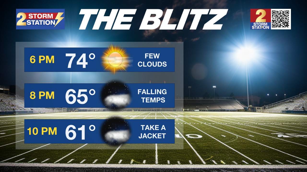
With the loss of daytime heating, temperatures will drop quickly. But that will make for a picture perfect fall football evening for the Friday Night Blitz. With mostly clear skies, temperatures will settle into the 60s during the games. Take a layer to add.
Up Next: All clear conditions persist through the weekend. With a lack of northerly winds pushing cooler air into the region, expect temperatures to inch higher each day. Highs will be in the low to mid-80s with lows in the low to mid-50s. By early next week, the gradual temperature moderation will continue with highs peaking in the mid-80s. There are some signs that high-level clouds will begin to spill into skies by midweek, potentially limiting additional warming. Still, no rain is in the forecast.
College Football: On The Bluff, Southern Homecoming couldn’t ask for much better weather. Some light layers may be wanted for morning and evening but tailgating and afternoon festivities will have sun and temperatures in the low-80s. LSU fans hitting the road can expect clear and chilly conditions in Fayetteville. Temperatures will move from the mid-40s around dawn to mid-70s in the afternoon and retreat into the 60s and 50s during the game. You can find out how LSU historically performs in these conditions via the Storm Station's LSU Kickoff Weather Index HERE.
Trending News
Get the latest 7-day forecast and real time weather updates HERE.
Watch live news HERE.
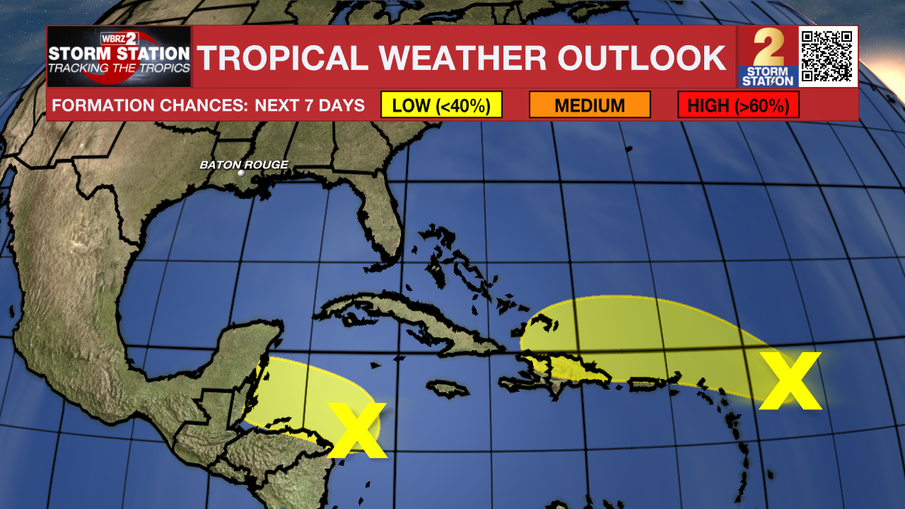
The Tropics: Showers and thunderstorms associated with a trough of low pressure located a couple hundred miles east of the Leeward Islands remains disorganized. Some slow development is possible in the coming days as the system passes near the Virgin Islands and Puerto Rico on Friday, then near Hispaniola and southeastern Bahamas on Saturday. Strong upper-level winds will prevent additional development by late in the weekend. For now, the system has low odds of tropical formation between now and then.
Showers and thunderstorms over the southwestern Caribbean Sea are associated with a broad area of low pressure. Gradual development of this system is possible before it moves inland over Central America. Regardless of development, locally heavy rainfall is possible across portions of Central America and southern Mexico later this week and into the weekend.
-- Meteorologist Malcolm Byron
The Storm Station is here for you, on every platform. Your weather updates can be found on News 2, wbrz.com, and the WBRZ WX App on your Apple or Android device. Follow WBRZ Weather on Facebook and Twitter for even more weather updates while you are on the go.
More News
